I discussed Isaiah Bowman in my article Thinking in Space, especially in the earlier, longer version. Bowman’s book, The New World: Problems of Political Geography, was first published 100 years ago this year. Neil Smith’s book American Empire is really great on Bowman and his ties to Wilson and Roosevelt.
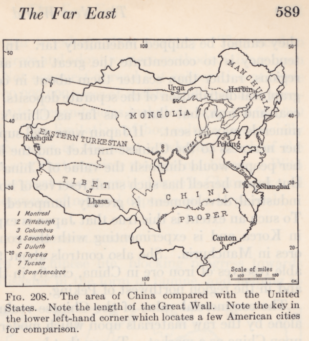
Given my recent interest in depictions of comparative area, I thought I would highlight these two examples from his book. One overlays the borders of the contiguous United States on top of a map of China.
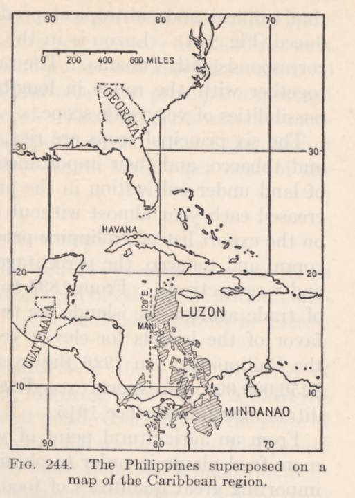
The second map is also compelling not only for comparative area of the Philippines, but also for comparative latitude. This is a very interesting map in light of American foreign policy of the period that sought to exert control in both the Philippines and in the Caribbean basin.